Natural resources
Georgian forests
Georgian forests are great national treasure. The constitution of Georgia urges all citizens to treat nature carefully with respect and accordingly the same attitude is expected to the forests an important strategic source of our country. The concept of stable management of forests in Georgia stems from understanding of ecological, economic and social importance of forests. Ecological, economic and political aspects of forest management are a part of national development strategy and stable development of the country. The purpose of stable forest management is to satisfy basic needs of the society in forest resources on the basis of scientific rational multipurpose non-depleting usage, protection and reproduction saving biologic variety of the forests.
Georgia is one of the most ancient countries in the world, a part of the Caucasus with 5.5 million populations. The territory is 6.5 million hectares. Georgia borders Russia in the north, Azerbaijan in the east, Armenia and Turkey in the south and the Black Sea in the west. Forest areas occupy 3005.3 thousand hectares while pure forestry accounts for 2772.4 hectares which is 40% of the country's territory. The total timber resources of the world are estimated at 360 billion cubic meters, in the Georgian mountains these resources are estimated at 451.7 million cubic meters i.e. 0.13% of the world resources. Average forest density in the world is 100 square meters per hectare, in Georgia it is 163 square meters. 97% (2915.8 hectares) of Georgian forestry are situated on mountain slopes, the rest 3% are low-lying and flood plain forest in Kolhida region and in the west of Georgia. On the slopes the forests density is following 010 .5. % (165 thousand square hectares, 1120 16.5% (496 thousand hectares), 2125 16.6% (499 thousand square hectares)), 2630 18.2% (547 thousand hectares), 3135 19.6% (589 thousands hectares) 36 and higher 23.6% (710.4 hectares) Georgia defines forests according to age which might be of special interest. Mature trees dominate, 33.4 % (852.3 thousand hectares), ripe and old age plants 35.4% (904.4 thousand hectares), which gives opportunity to test and carry out regenerating measures. The tree types are distributed as follows: the beech 1060 thousand hectares. 46.6 %, the fir 161.5 thousand hectares. 7.1 %, the pine 91.0 thousand hectares. 4.0 %, the oak 241 thousand hectares. 10.6 %, the alder 125.1 thousand hectares. 5.5 %, the Chestnut 72.8 thousand hectares. 3.2 %, the hornbeam 220.6 thousand hectares 8.8 %, the Fir-tree 102.0 thousand hectares 4.5 % and other types 220.6 thousand hectares. 9.7 %. Above sea level the areas of forests are distributed in the following order: 100 m. above sea level. 2 %, 101500 m. above sea level. 5 %, 5011000 m. above sea level. 20 %, 1001 1500 m. above sea level. 35 %, 15012000 m. above sea level. 31 %, 2001ј and the rest 7 %. Distribution of the areas according to the category is the following: Reserves 168.9 above sea level. National parks 61.4 above sea level, Protected reserves 12.4 above, Forests in green zones 276.5 thousand hectares, Resort woods 119.4 thousand hectares, Soil-protective and Water-protecting forests 2366.7 thousand hectares.
| Protected Area | Management type | Size in hectares | Marine area | IUCN Category | Latitude | Longitude |
| Ajameti | Nature Reserve | 4,845 | IV | -14.519105 | 22.573145 | |
| Akhmeta | Nature Reserve | 16,297 | -12.260223 | 30.86119 | ||
| Algety | Nature Reserve | 6,822 | III | -17.875123 | 25.81281 | |
| Bichvinta-Miusera | Nature Reserve | 3,645 | -8.659493 | 29.44296 | ||
| Borjomi | Nature Reserve | 17,948 | -11.125663 | 30.57781 | ||
| Kazbegi | Nature Reserve | 8,707 | -12.517351 | 32.23696 | ||
| Kintrishi | Nature Reserve | 13,893 | IV | -12.582472 | 30.21586 | |
| Kolkheti | Nature Reserve | 500 | IV | -12.7526 | 32.58976 | |
| Lagodekhi | Nature Reserve | 17,932 | IV | -16.397579 | 25.984675 | |
| Liakhvi | Nature Reserve | 6,388 | IV | -10.6 | 33.61 | |
| Mariamjvari | Nature Reserve | 1,040 | IV | -12.16 | 24.83 | |
| Pskhu-Gumista | Nature Reserve | 40,819 | IV | -15.98 | 27.25 | |
| Ritsa | Nature Reserve | 16,288 | IV | -12.98 | 27.85 | |
| Saguramo | Nature Reserve | 5,359 | III | -9.86 | 28.95 | |
| Sataplia | Nature Reserve | 354 | -10.11 | 30.58 | ||
| Vashlovani | Nature Reserve | 8,034 | III | -8.6 | 31.25 |
Water Resources
Georgia is rich with water resources. There are 26060 rivers and their total length is about 59 thousand kilometers. In the hydro-geographical network the important part (99%) makes the small rivers (length - less than 25 km).
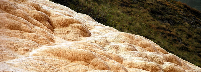
There are a lot of thermal and mineral water springs in the country. There are many natural and mechanic water reservoirs. Important supplies of ground water are in limestone horizons on the territory of Caucasus.
Water resources are distributed unequally and they are mainly in the west part of the country. Georgian rivers are distributed into two main basins and they are divided by Likhi ridge. There are about 18109 rivers are in the Black Sea basin. This is 70% of total rivers. There are 7951 rivers (30%) in the Caspian Sea basin. 555 rivers of the Black Sea basin and 528 rivers of the Caspian Sea basin are studied hydrologically.
Nearly all rivers of East Georgia make the whole system and flows down into the Caspian Sea and West Georgian rivers join the Black Sea independently. The biggest river of Georgia is Mtkvari. Only its middle part (400 kilometer) is on the territory of Georgia. It begins in Turkey and flows down in the Caspian Sea on the territory of Azerbaijan. The largest river in West Georgia is Rioni. It covers only the territory of Georgia. It begins in Great Caucasus Mountains goes through Kutaisi and Poti into the Black Sea.
There are about 860 lakes in Georgia. Most of them are very small so their water surface area is about 170 km2. (It consists of 0.24% of territory if the country). Most of them are fresh waters. Paraoni Lake has the largest area in Georgia. Tabatskuri Lake is the biggest one with its volume and Ritsa is the deepest lake not only in Georgia but in South Caucasus too.
In Georgia wetlands cover 225 thousand ha on Kolkheti Lowlands.
West Georgia is bordered by the Black Sea and its coastal zone along Georgian border is 315 kilometer.
43 reservoirs serve to hydroelectric stations and irrigation system. 35 ones among them are in East Georgia. Water reservoirs are very important in economics of Georgia. Nowadays in Georgia more than 75% of electric energy is generated in hydroelectric stations. Irrigation system has vital importance for agriculture in the East Georgia that is drier part of the country.
Natural supply of fresh ground water of the country is about 18000 million cubic meters. The whole prognosticate and exploitation supplies are about 10600 million cubic meters.
There are a lot of ground water storage, especially on the lower slope of Great Caucasus and on the plateau of Akhalkalaki and Marneuli. The total debit of these springs is 340 m3 in a second. In total water supply systems provide 600 million cubic meter drinking water a year. 90% of this drinking water is based on ground water and they do not need any special generation besides chlorination.
Now water resource management is on the base of administrative principles in Georgia. It is less effective following the nature of water and reality that ‘water does not know any borders'. Administrative model cannot provide planning effective usage of water resources within river basin on the bases of interests of water beneficiaries and also considering environmental purposes.
Georgian rivers are mainly polluted with nitrogen or sometimes with heavy metals (River Mashavera, Bolnisi Region; River Kvirila, near Chiatura and Zestafoni) and rivers of the Black Sea in Adjara Regions are polluted with oil products.
The main sources of polluting surface waters in Georgia are water supply and sewerage system, heat power engineering and industry.
Water pollutants according to the sectors are distributed as follows:
- Water supply and sewerage system - 344,1 million cubic meter a year. (67%)
- Heat power engineering - 163,8 million cubic meter a year. (31%)
- Industry - 9,6 million cubic meter a year. (2%)
So the main pollutant for surface waters is communal sector (sewerage of towns and populated areas). Now none of the water cleaning structures can provide cleaning according to project quality. Biological cleaning of water is not available in any towns. Primary mechanic cleaning is implemented only on Tbilisi-Rustavi regional cleaning structure. As a result, there is important pollution on water objects.
Land and Land Resources
Georgia is situated in the south-east part of Europe between Turkey, Armenia, Azerbaijan, Russia and the Black Sea. The length of costal zone is 310 km; the length of land border covers 1838 km that consists of the following according to the neighboring countries: length of land border to Russia is 894 km, length of land border to Azerbaijan is 445 km, length of land border to Armenia is 224 km, length of land border to Turkey is 275 km. The whole length of Georgian border is about 2148 km.
Land area of the country is 6949, 4 thousand ha. In 2002, according to Georgian Law ‘About Water', the area of territorial water was counted and defined as 679,0 thousand ha. As a result, the whole area of the country has been determined as 7628,4 thousand ha since January 1, 2002 and 3025,8 thousand ha (39,7%) out of it is agricultural land.
Intensive usage land - arable and perennial plantations, is 1065,3 thousand ha (35,2% of the whole agricultural land) and that consists of 802,1 thousand ha arable land (26,5%), 263,5 thousand ha perennial plantations (8,7%), 143,5 thousand ha mowing land (4,7%), 1796,6 thousand ha pastures (59,4%).
20,1 thousand ha (0,7%) of agricultural lands is covered by buildings and yards. 60,3% or 4602,6 thousand ha of territory of the country is shrubberies, water, roads, buildings and other unused areas (rocks, ravines, erosion land, cemeteries).
2838,3 thousand ha (33,3%) of the whole territory of the country is covered by forest; 11,5 thousand ha (0,2%) is field protection wood zone; 154,7 thousand ha (2,1%) is wood shrubbery; 17,1 thousand ha (0,2%) is wetland;
876,5 thousand ha (11,5%); is covered by water: 91,3 thousand ha (1,2%) is rivers and streams, 17,9 thousand ha (0,2%) is reservoirs, 21,3 thousand ha (0,3%) is glaciers, 17,5 thousand ha (0,2%) is lakes, 1,0 thousand ha (0,01%) is puddles, 49,0 thousand ha (0,6%) is main line canals and its networks, 678,5 thousand ha (8,9%) is the Black Sea territorial water, 291,2 thousand ha (3,8%) is roads, 108,1 thousand ha (1,4%) is buildings, 6,3 thousand ha (0,1%) is damaged lands.
298,9 thousand ha (3,9%) is unused non-agricultural land that consists of 18,4 thousand ha (0,2%) is rocks, 2,4 thousand ha (0,3%) is sands, 171,3 thousand ha (2,2%) is ravines, 4,1 thousand ha (0,05%) is cemeteries, 102,7 thousand ha (1,3%) is erosion land.